NOTAM Briefer
BetaEvery NOTAM, pinned to your route.
Free during beta · Web
Dozens of NOTAMs per flight, most of them unrelated to you. NOTAM Briefer geolocates every one, ranks them by severity, and keeps only the ones that touch your airfield, or your route.


100 NOTAMs. One critical item hiding inside.
A simple local flight often pulls 20+ NOTAMs; a route pulls ten times that. Reading the full stream of coded text takes time you don't have. NOTAM Briefer does the sorting, plots each NOTAM on the map, and lets you see at a glance what actually matters.
A single airfield, or an entire route

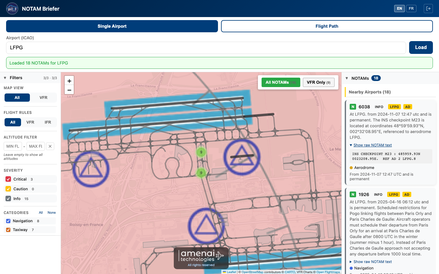
Single airport
Enter an ICAO code. Every NOTAM for the airfield and its immediate vicinity is displayed, ranked by severity, perfect for local flights, pattern work, or scouting an unfamiliar airfield.
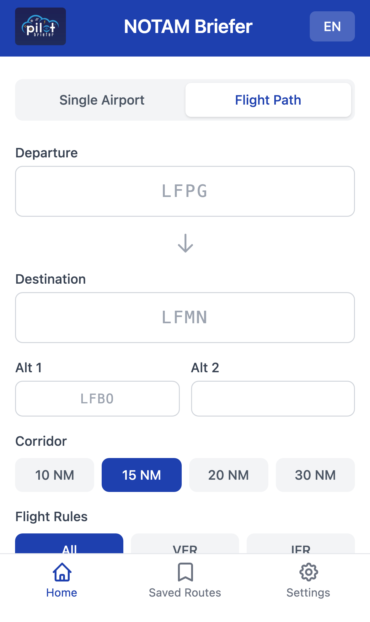
Flight path
Departure, destination, up to two alternates. Pick a corridor width (10 to 30 NM). NOTAM Briefer keeps only NOTAMs inside that corridor and at the airfields, split between airport and en-route.
Three levels, one quick decision
Each NOTAM is scored by a classifier that weighs category, keywords (closure, prohibition, obstacle), affected altitude, and time-to-activation.
Critical
Runway closures, prohibited airspace, TFR zones, NOTAMs activating within two hours. Read first, always.
Caution
Temporary obstacles: cranes, wind turbines, balloons, parachuting, fireworks, bird activity: anything that alters the picture of the airfield or sector.
Info
Aerodrome services, communications, lighting, taxiway works. Worth knowing, no immediate operational impact.
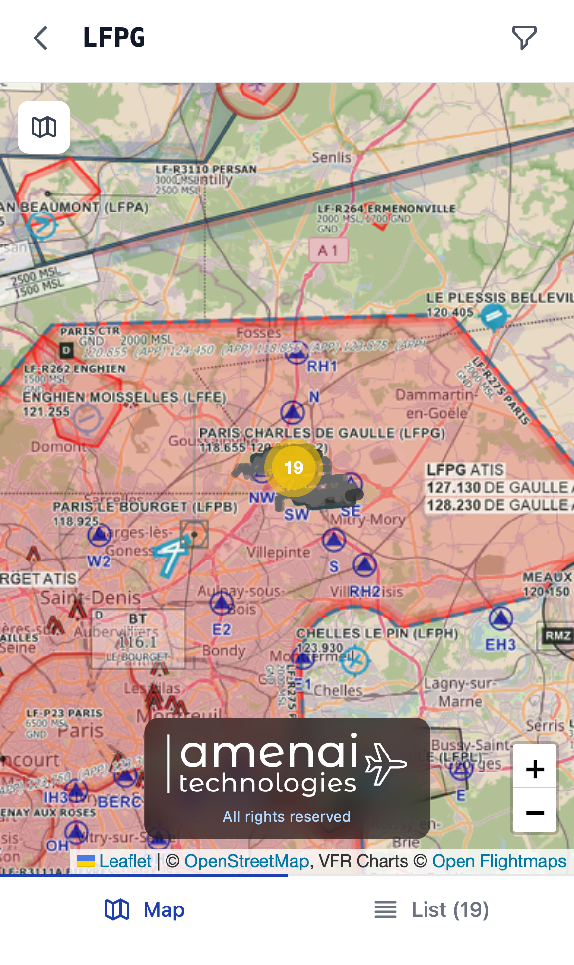
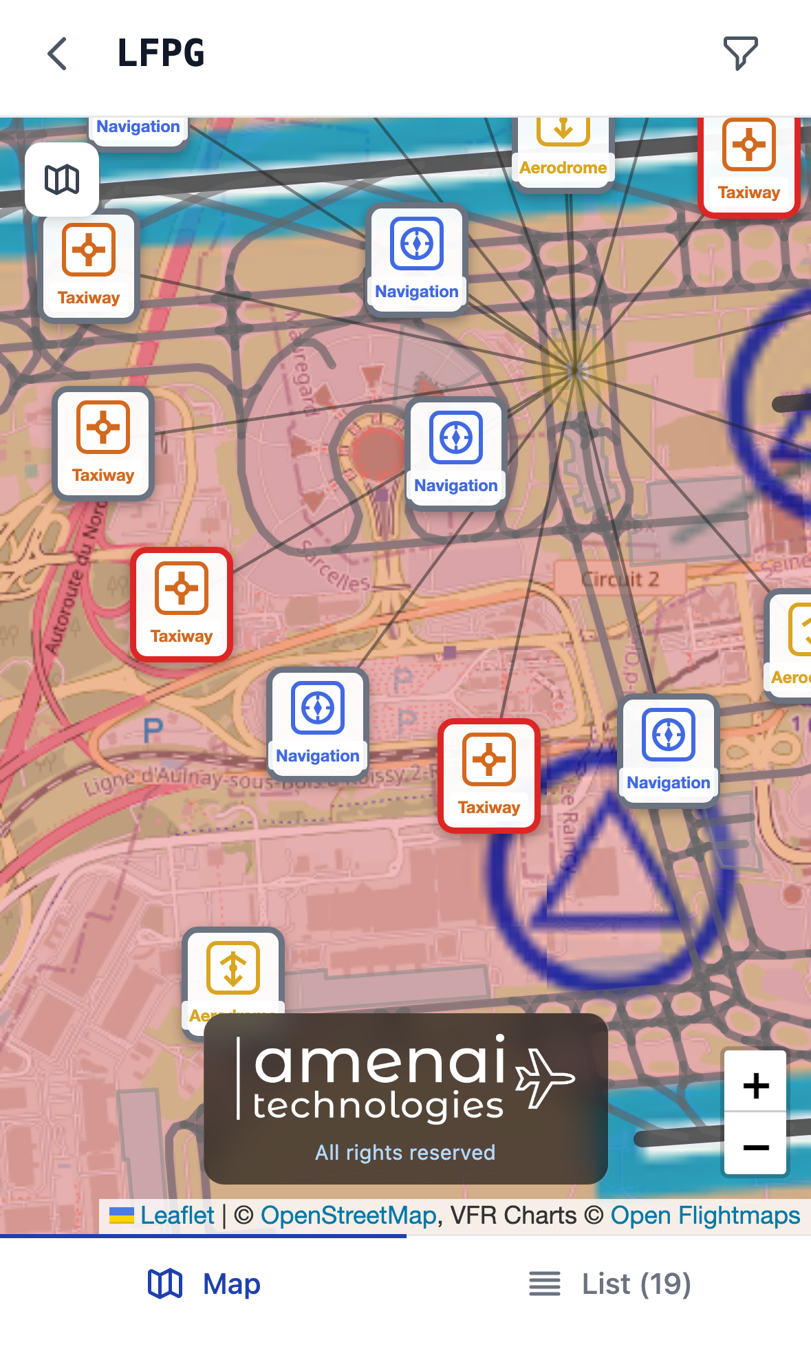
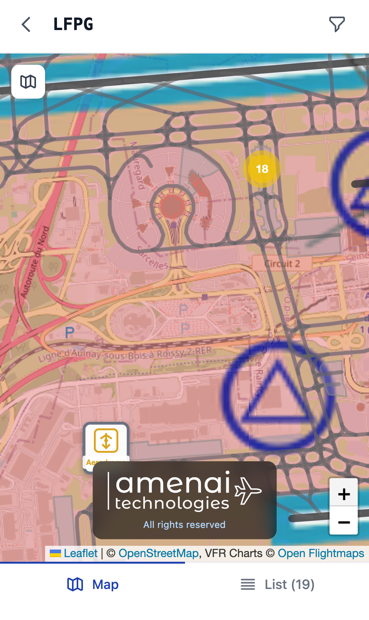
One icon per category. Legible at a glance.
The classifier decodes ICAO Q-codes and keywords to assign each NOTAM a category. On the map, icons cluster automatically by zoom, and fan out in a "spider" pattern around an airfield as you zoom in.
- Aerodrome
- Runway, Taxiway, Apron
- Navigation (VOR, ILS, RNAV)
- Airspace / Military
- Obstacles (cranes, masts, turbines)
- Activities (parachute, drone, balloon)
- Lighting / Communication
- ATS
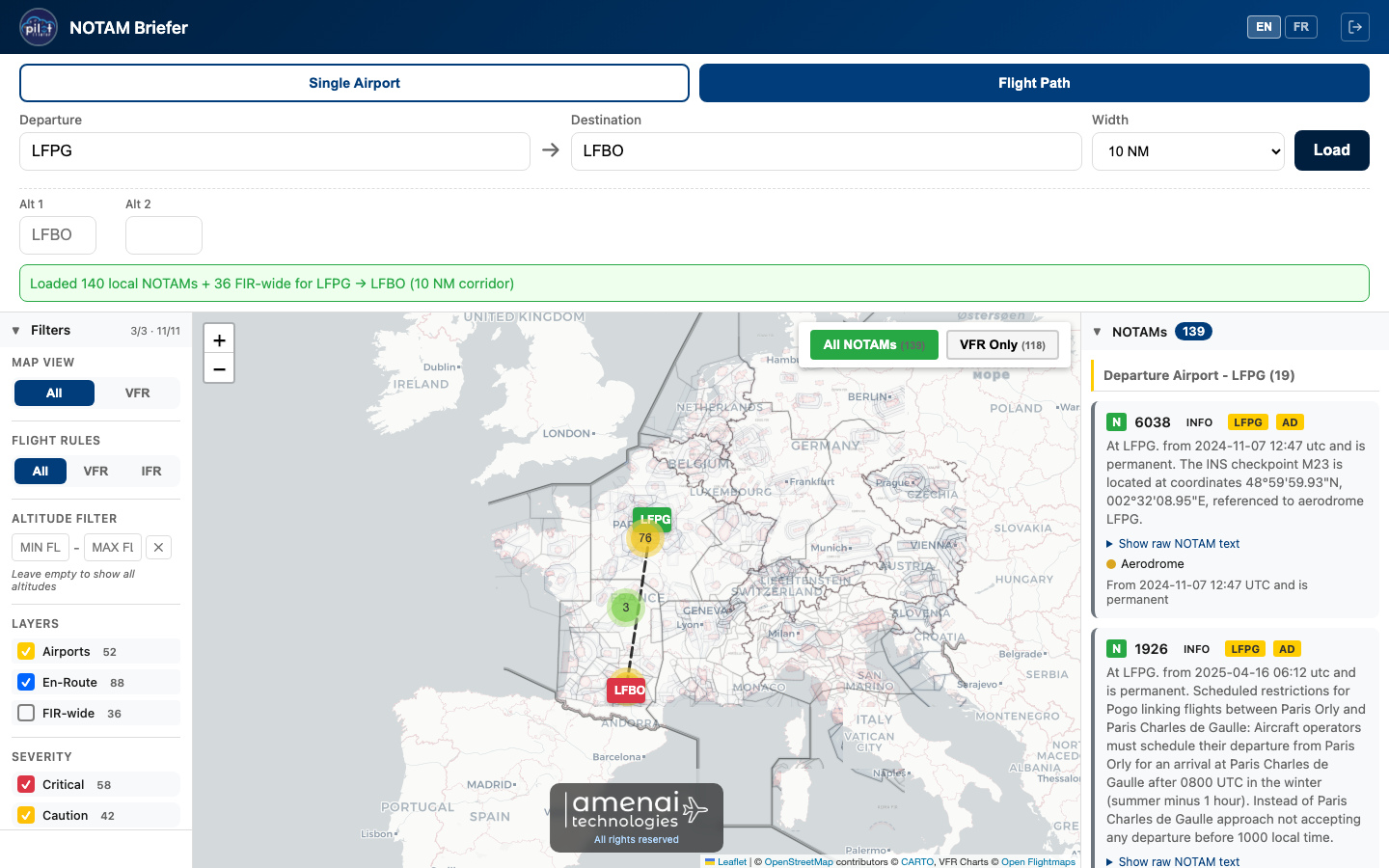
A flight corridor, NOTAMs filtered
A spatial index organizes NOTAMs by geographic tiles; a geometric filter then keeps only those that actually intersect your corridor. Airport NOTAMs and en-route NOTAMs stay separate.
Inside France
LFPG → LFBO
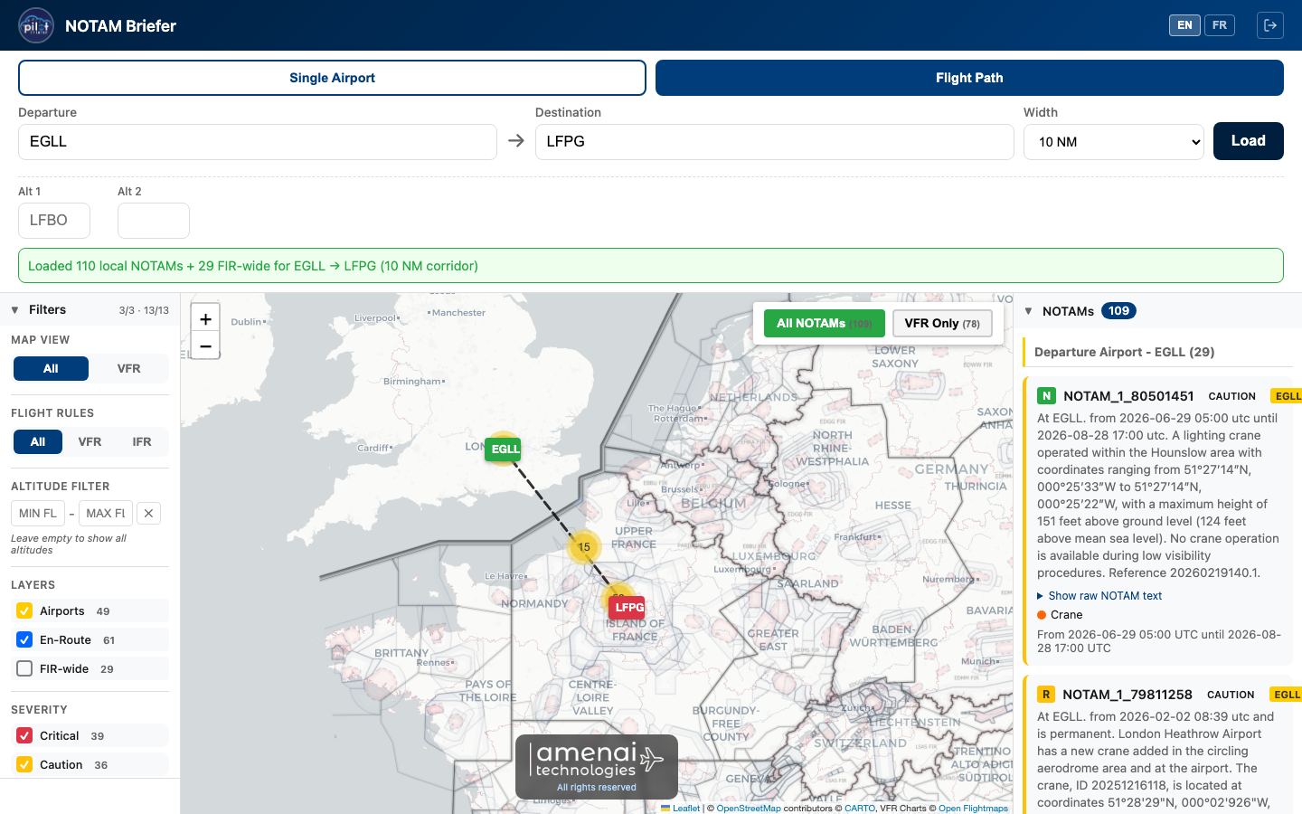
International
EGLL → LFPG
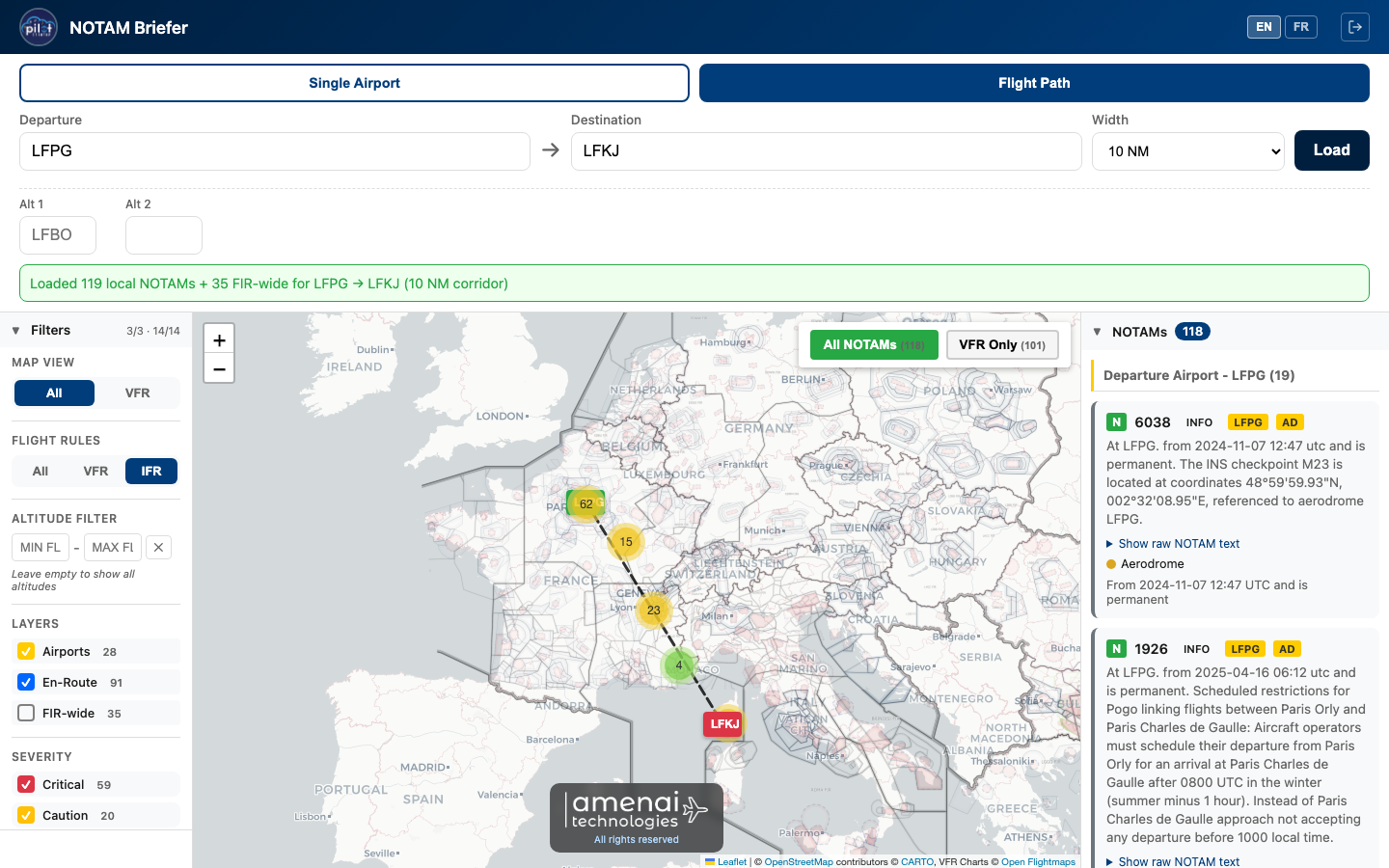
Long route
LFPG → LFKJ
Built for the mobile cockpit
Dedicated mobile interface: map on top, list one tap away. Your recent briefings and settings are at your fingertips.
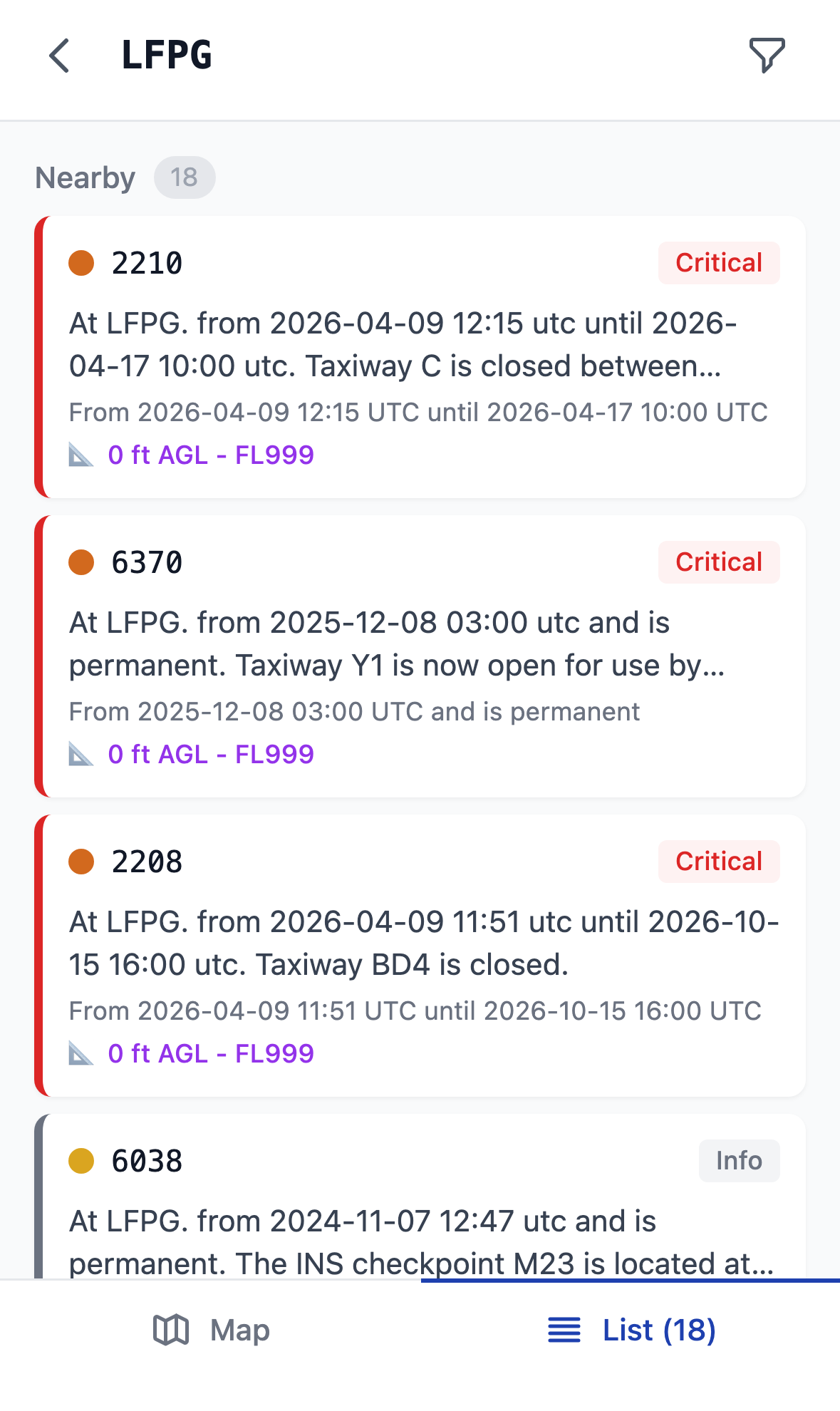
List view
Every NOTAM sorted by severity, with its plain-language summary, validity period, and altitude band.
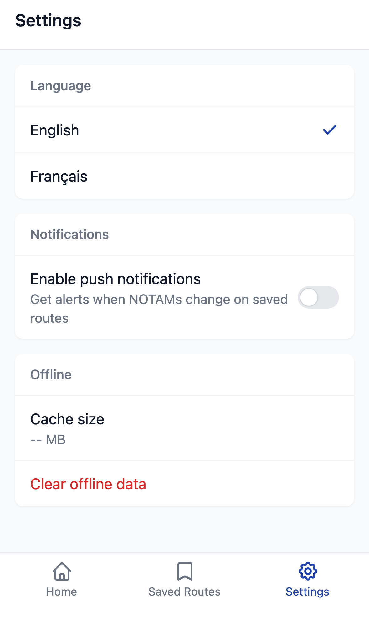
Settings
Language, push notifications on NOTAM changes, offline cache control: all from the Settings tab.
Raw text, plain language.
Every NOTAM gets a plain-language summary in English and French, generated by an AI model that keeps technical codes (RWY, TWY, ILS, FL) intact while expanding abbreviations (CLSD, OOS, U/S, PN). The source text stays one click away for verification.
- Two-pass interpretation: first into clean English, then translated to aviation French.
- Units preserved: feet, knots, flight levels, coordinates.
- Translations cached, no latency on second look.
What it can do
Geolocation
DMS coordinates, radial-distance, Q-codes: all converted to a point or circle on the map.
AI classification
Severity engine combining 204 Q-codes, category, altitude and time-to-activation.
FAA + France coverage
US domestic NOTAMs, international NOTAMs via FAA, and French NOTAMs from the official PIB.
Regular refresh
FAA data refreshed every 3 hours; French NOTAMs processed as the PIB arrives.
Powerful filters
VFR / IFR, altitude band, severity, category: combine what matters for your flight.
Map layers
Airports, en-route, FIR-wide: toggle on or off to declutter the map when needed.
French / English
Bilingual interface and interpretation; aviation terminology preserved (runway, taxiway).
Recent queries
Last searches are saved locally so you can come back in one tap.
A visualization tool, not an official briefing
NOTAM Briefer is in beta. It's a visualization aid, not a replacement for the official briefing from your aeronautical information provider (FAA, SIA, Eurocontrol). The pilot remains responsible for flight preparation and the go/no-go decision.
Try NOTAM Briefer in beta.
Free access via secure email link. Your feedback shapes what comes next.
Try the beta